
Maggie Williams (Geoscience educator and co-founder and content developer for GeoHubLiverpool) and has been involved with geological field classes and undergraduate practical classes at the University of Liverpool for several years. Following a recent talk by Sandy Drymoni (University of Milan-Bicocca), held as part of the ESRG Seminar series at the University of Liverpool, Maggie shares her views on fieldwork and Sandy’s inspiring talk.

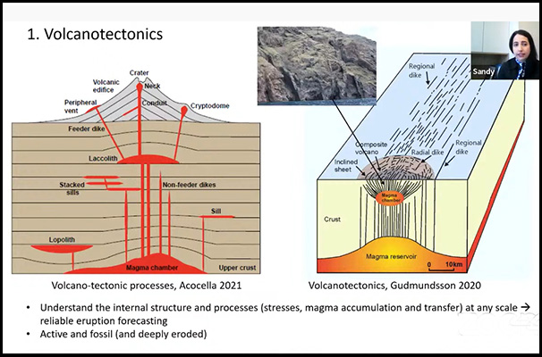
Dyking is the most common process of magma ascent in the shallow crust. Dykes and inclined sheets are known occasionally to exploit faults as parts of their paths, but the conditions that allow this to happen are still not fully understood. Sandy began her talk with an outline of volcano-tectonics, but her focus was on Santorini, Greece. This island was the site of one of the largest volcanic eruptions in recorded history: the Minoan eruption.
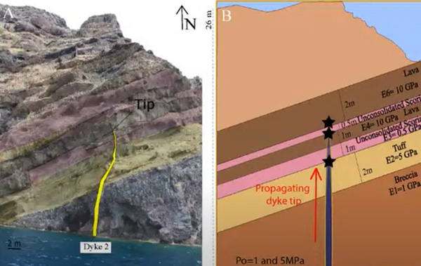
Sandy’s introduction was followed by a summary of her field observations from a swarm composed of 91 segments of dykes and inclined sheets. This swarm is well-exposed in layered caldera walls of the Santorini volcano, Greece. I was impressed by the detail in which Sandy had recorded the rocks exposed in the caldera walls and the graphics she used to show the stratigraphy, host rock lithologies and the cross-cutting relationships shown by the igneous intrusions
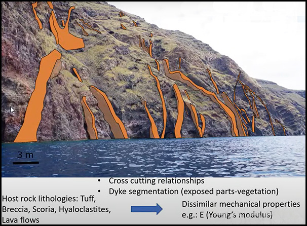
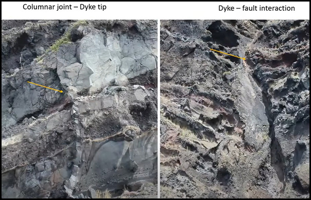
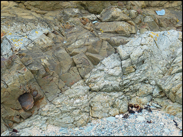
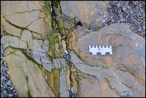
The structural field-based study revealed that most of the dyke segments had a dip close to vertical. It also showed at least four distinct dyke populations and two different dyke paths: propagated and deflected. The host rock was heterogeneous and consisted of lava flows, scoria, tuffs, and hyaloclastites. Illustrations used in the talk included field photographs of showing details such as dyke tips and dyke-fault interactions
In her talk, Sandy combined her field data with numerical models to explore dyke paths resulting in (1) arrest and (2) eruption as well as new analytical and numerical models to explain the mechanical principles of dyke/sheet deflections into faults. For the models that Sandy generated the aim had been to replicate as closely as possible the conditions in the host rock, stratigraphy, and mechanical properties. For each contact three boundary conditions were defined: the stress concentration at the tip, stress rotation at the tip and its vicinity and the possible dyke path.
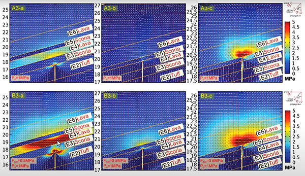
Sandy’s models showed that dyke deflection is encouraged by three main factors.
1. If the fault core is soft (E ≤0.1GPa) and hence active.
2. If the dyke-fault angle is steep and the fault core is relatively stiff (E ≤1GPa).
3. If the fault core is thick (>5m) and relatively stiff (E ≤1GPa).
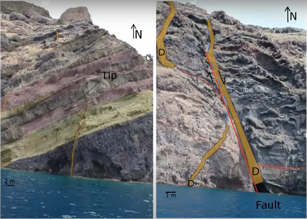
Additional illustrations in this excellent talk included paired field photographs and cross sections showing the boundary layers and the different values of Young’s modulus (E).

In summary, I found this talk inspiring. It confirmed my view that we need to make detailed observations when undertaking field work and that such observations are essential if we are to develop reliable volcano-tectonic models for forecasting volcanic eruptions. It also ensured that I will aim to revisit geological sites in Anglesey to re-examine dykes I’ve seen and used in my own teaching programmes!
Click on the image to the left to see a clip of part of Sandy’s talk: ‘Dyke propagation paths: Insights from field observations and numerical modelling’.
For further information about this exciting research click here.
Leave a Reply