
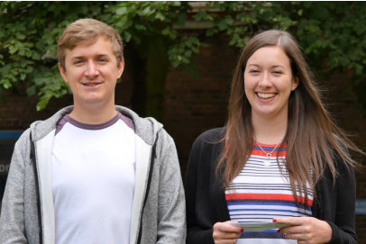
THE VIDEOCLIPS
These 16 videoclips illustrate some of the practical skills and
techniques used when undertaking geological fieldwork. The
techniques are demonstrated by Jess and Jack, two
undergraduates at the University of Liverpool.

SPONSORED BY THE PETROLEUM EXPLORATION SOCIETY OF GREAT BRITAIN


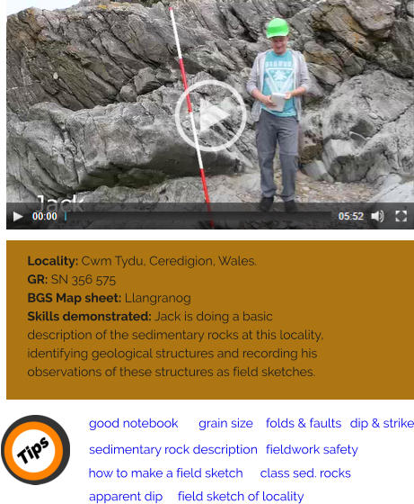
Locality: Traeth Bychan,
Anglesey, North Wales
GR: SH 517 846
BGS Map sheet: Anglesey
Skills demonstrated: Here
Jess demonstrates how to
draw a generalised sketch
graphic log for an outcrop
where limestone units are
exposed in a cliff section.
Jess points out the
conventions used to
produce a graphic log
(pictorial representation of
the rock succession) and
gives advice about
information to record in the
field about fossils.


![[x]](index_htm_files/close.png "Close")

THE VIDEOCLIPS
These 16 videoclips illustrate some of the practical skills
and techniques used when undertaking geological
fieldwork. The techniques are demonstrated by Jess and
Jack, two undergraduates at the University of Liverpool.


Sponsored by P.E.S.G.B.

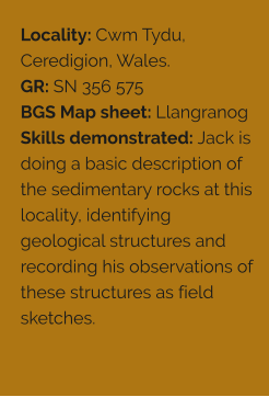
Locality: Pothole valley, near Llanferres, North Wales
GR: SJ 192 597
BGS Map sheet: Flint
Skills demonstrated: Jack is looking at bedded
limestones and demonstrating how to measure the dip &
strike of the bedding in these rocks. He shows how dip &
strike can be measured either by using a compass
clinometer or by using a separate clinometer and a
compass. Jack also explains how to set up a fieldwork
notebook.
Locality: Moelfre, Anglesey, North Wales. (Moelfre
harbour and Y Swnt headland)
GR:SH 512 863 & SH 517 867
BGS Map sheet: Anglesey
Skills demonstrated: At Moelfre, Jack visits two localities
where limestones are exposed. At the first locality Jack
demonstrates how to measure apparent dip. At the
second locality Jack demonstrates how to measure dip
and strike on uneven bedding planes. He shows how to
record these structural measurements in a field notebook
and shows how to identify the type of limestone exposed
in the Y Swnt headland at Moelfre.
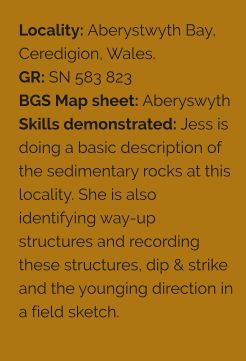
Locality: Aberystwyth Bay, Ceredigion, Wales.
GR: SN 583 823
BGS Map sheet: Aberyswyth
Skills demonstrated: Jess is doing a basic description
of the sedimentary rocks at this locality. She is also
identifying way-up structures and recording these
structures, dip & strike and the younging direction in a
field sketch.
Locality: Hilbre Island, Wirral, England
GR: SJ 187 877
BGS Map sheet: Liverpool
Skills demonstrated: Jack demonstrates how to set up a
field notebook in the field and record basic information
about a locality including data, weather conditions,
hazards, and the aims of his field investigation. He also
shows how to use a 1:50000 OS map to locate the
geological features he is studying and produce a six figure
grid reference for the locality.
Locality: Hilbre Island, Wirral, England
GR: SJ 187 877
BGS Map sheet: Liverpool
Skills demonstrated: Jack demonstrates how to describe
an outcrop and identify different packages of sedimentary
rocks. He then shows how to use a hand lens and grain
size card to make observations about sedimentary rocks.
Jack makes it clear that you need to take a close look at
the rocks and when you record your observations you
need to keep these separate from your interpretations.
Locality: Hilbre Island, Wirral, England
GR: SJ 187 877
BGS Map sheet: Liverpool
Skills demonstrated: Jack demonstrates how to produce
a graphic log or a visual representation of the vertical
succession he has looked at and has described in a
previous clip. Jack explains how to use a graphic log
sheet. He makes it clear that the observations and
interpretations have to be kept separate on the graphic
log.
Locality: Moel Findeg, Clwyd, North Wales
GR: SJ 208 612
BGS Map sheet: Flint
Skills demonstrated: Jess is demonstrating how to
investigate a rock outcrop where packages of limestone
and clastic sedimentary rocks are exposed. She also
demonstrates how to complete a graphic log sheet that
records the rock succession at this locality.
Locality: Traeth Bychan, Anglesey, North Wales
GR: SH 517 846
BGS Map sheet: Anglesey
Skills demonstrated: Here Jess demonstrates how to
draw a generalised sketch graphic log for an outcrop
where limestone units are exposed in a cliff section. Jess
points out the conventions used to produce a graphic log
(pictorial representation of the rock succession) and gives
advice about information to record in the field about
fossils.
Locality: Valley, Anglesey, North Wales
GR: SH 285 802
BGS Map sheet: Anglesey
Skills demonstrated: At this locality Jess is doing a basic
description of the metamorphic rocks exposed here. She
is identifying small scale geological structures, recording
her observations as a field sketch and drawing her initial
conclusion about the sequence of geological events that
occurred at this locality.
Locality: Rhosneigr, Anglesey, North Wales
GR: SH 316 326
BGS Map sheet: Anglesey
Skills demonstrated: At this locality Jack is identifying
different geological structures developed in interbedded
mudstones and sandstones. He demonstrates how to
recognise antiforms, synforms, cleavage and refracted
cleavage. He shows how way-up structures can be used
to indicate younging direction and demonstrates how
information about geological structures may be recorded
in a field sketch.
Locality: Llanddwyn, Anglesey, North Wales
GR: SH 391 634
BGS Map sheet: Anglesey
Skills demonstrated: In this video Jack is investigating
igneous rocks, describing these rocks and using way-up
structures in the rocks to determine the direction of
younging.
Locality: Traeth Bychan, Anglesey, North Wales.
GR: SH 517 846
BGS Map sheet: Anglesey
Skills demonstrated: At this locality Jack is investigating a
cliff section, identifying a small igneous body intruded into
layered sedimentary rocks and recording his observations
on a field sketch.
Locality: Porth-y-Post, Anglesey, North Wales
GR: SH 243 796
BGS Map sheet: Anglesey
Skills demonstrated: Here Jess is identifying igneous
bodies intruded into foliated metamorphic rocks and
recording her observations on a field sketch.
Locality: Hilbre Island, Wirral
GR: SJ 187 876
BGS Map sheet: Liverpool
Skills demonstrated: Jess is identifying geological
structures, recording her observations as a field sketch
and drawing a basic conclusion about the sequence of
events that took place at this locality.
*Wind levels were high here so we have added subtitles.
Locality: Porth Saint, Rhoscolyn, Anglesey, North Wales.
GR: SH 261 758
BGS Map sheet: Anglesey
Skills demonstrated: Here Jess is identifying larger
scale geological structures (folds & faults) and recording
her structural observations and apparent dip
measurements in a field sketch.


J O I N T P R O J E C T


